Saturday, January 22, 2011

How We Got to Mt Apo's Peak

(via Kapatagan Trail)


There are several known trails for you to be able to reach the top of the Philippine’s highest peak, Mt. Apo. One of those trails is via Brgy. Kapatagan in Digos, Davao del Sur. For an additional information, Brgy. Kapatagan is known to be the vegetable basket of the region. It is situated about 1,200 masl, but the access going to and from the centre is, somehow, convenient since the road has already been developed into concrete highways. Anyway, going back to climbing Apo, our team decided to take the Kapatagan trail because we wanted to experience passing the volcanic rock boulders and reach the mountain’s sulphuric vent.

We went off from General Santos City at 3P.M. and arrived at Digos Land Terminal at around 4P.M. We also met our mountain guides and porters at the terminal (porter fee is Php400/day). From there, we rented a jeepney (Php 3,000) going to Brgy. Kapatagan. It was already around 5P.M. when we arrived at the Military Post Camp at Sitio Baras (just fronting the way to Camp Sabros) to register. Registration Fees for entering mountaineers are as follows:

                Students:                           Php 400.00
                Local Climbers:                  Php 700.00
                Foreign Climbers:               Php 1000.00

Sitio Baras Military Post

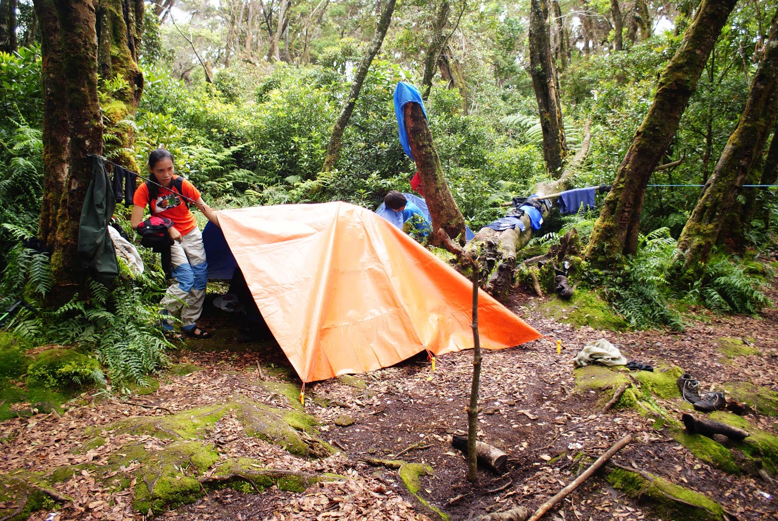
After the registration, we then headed to the barangggay’s public market and transferred to a more powerful vehicle (Php 1000) transporting us to Sitio ­­Mainit. We did a night trek from Sitio Mainit going to Sitio Paradise (the last sitio of Brgy. Kapatagan), where we had our first camp. We got there at around 10P.M.  
Camp Sitio Paradise

Camp Upper Sabwag

Camp Godi Godi

           The next day, we jumped off at 7A.M. for a 6 to 8-hour trek going to the next camp site (Camp Godi- Godi). That was the start of our intense forest trek. As expected, the trail was muddy and slippery because it rained the night before. We passed two smaller campsites (Camp Upper Sabwag and Camp Baroring) where we refilled our drinking water. The camps are the last sources of clean drinking water, although, Camp Godi-Godi also has a water source. Our teamleader just advised us to use the water at Godi-Godi for cooking/heating since it is already slightly contaminated with sulfur. The river stream at Camp Baroring is cold and very refreshing, and since we still had enough time, we took the opportunity to plunge and rejuvenate ourselves. We arrived at Camp Godi-Godi at around 1P.M. Since some members of our team arrived two hours later, we decided to stay at the camp for a night. The trail at Boulders’ Phase gets foggy in the afternoon, thus, it will be a risky climb in the cliff portions. Likewise, we won't be able to enjoy the panoramic views if we will proceed with the trek.

Boulders' Phase
We started going up to the peak as early as 6A.M. the next morning. After 45 minutes of warming up with a muddy forest trek, we already reached the opening of the Boulders’ Phase smelling the trace of the sulfur from the volcano's vent. The further we proceed, the bigger are the rocks which we need to climb although my fear of falling from a missed step was overpowered by the scenery of  Davao Gulf getting amazingly noticeable. We stayed almost 15 minutes in every stop taking as much photos as we could, capturing every angle of the view, and of course, relaxing our legs and arms. As we come closer to the sulfuric vent, the smell of was getting bad (sulfur smells like a rotten egg), although tolerable. For some, the smell tends to irritate the throat, so it is advisable to wear a face mask when climbing at the Boulders’ Phase. Some of us were brave enough to get closer to the vent and take pictures.
Camp Boracay
80 Degree Rock Wall
There is also another spot at the Boulders’ Phase called Camp Boracay. It is called so because the sand in this plain portion of Mt. Apo seems like that of Boracay’s. Some mountaineers stay overnight in that campsite, however, since there’s no water source, we were told to proceed at the peak's camp site. The last challenging part of the before reaching the top is to climb the 80° rock wall. There’s no other way but climbing through this wall. It seemed difficult to look at, but, when we started climbing, it was effortless. You just need to be careful though. 


             After 4 hours of conquering the Boulders' Phase, we already reached the peak. The chilling wind and it's strong velocity didn't even stop us from jumping around like children. It was such a fulfilling adventure overcoming the stressful forest trek, slippery trails, sulfur smell, and the heavy pour of the rain during camp.


FYI:       
There are 3 peaks in Mt. Apo and the Kapatagan peak was measured to be the highest. It is the basis of the 2,954 masl height of the mountain.
There is a wide camp site at the peak of Mt. Apo. The water source in here is drinkable. The temperature especially at night could go as low as 2° C.
...Read more

Mt. Apo Boulders' Phase


The best adventure that Kapatagan trail gives to mountaineers is passing through the Boulders' Phase. Huge rocks, the smell of sulfur, the slope and the cliff make the trail a challenging one.


...Read more

Mt Apo Campsites (Camp Godi-Godi)


Camp Godi-Godi is the last stop camp before the Boulders' Phase. Although big tall trees surrounds the area, the plain for campers' tents is wide. There is a spring in close proximity, but since the camp is just near the volcano's sulfuric vent, the water is already slightly contaminated with sulfur. Although, this can still be drunk as long as it is heated.


Just don't mind the socks and the vandals.


...Read more

Mt. Apo Campsites (Upper Sabwag and Baroring)


Campsites Upper Sabwag and Baroring don't have wider plains for campers to pitch their tents. However, some mountaineers do stopovers in these sites to have a replenishing plunge in the nearby river streams.   


...Read more

Mt. Apo Camp Sites (Camp Sitio Paradise)

Sitio Paradise is the last sitio in Baranggay Kapatagan, before entering the forested area of Mt. Apo.


...Read more

Tuesday, January 18, 2011

Friday, January 14, 2011

PSG in Siargao (Part 1)


This adventure was set about 3 months ago. It just took this long that the video was released (",). Quite a busy person in here.

Sunday, January 2, 2011

De-stress at Lake Agco


Lake Agco is in Ilomavis, Kidapawan City in Mindanao, Philippines. Being located at the foot of Mt. Apo, it is set to give their parokyanos the serenity of a green environment. Because it is hidden in the middle of the mountain's rich forest, it maintains its enchanted ambiance thus, making it one of the sought-after de-stress destinations for people wanting to escape from the busy demanding life of the metro.

   The lake has portions where the spring is hot enough to boil and cook an egg. The heat comes from the volcano's vent. According to scientific studies, a volcanic vent is enriched with therapeutic minerals such as Sulphur, thus, the mud of Lake Agco is also said to be therapeutic. But be careful not to have  burnt skin if you tend to rub it onto yours. A soft and gradual application is recommended. There are portions were the cold water springs out, best for you to plunge in. To conclude, the lake is a convergence of the hot and the cold water.


A mountain resort (Mahomanoy Mountain Resort) has been built to make it more convenient for people visiting there. Transportation is, likewise, not a problem since there are a lot of means on how to get there. There's a wide road and all you need to have is the right direction. The resort has the outdoor swimming pool as well as hot tubs for children and grownups alike... Not to mention, they have a natural sauna cave and a hot jacuzzi spring for people seeking relaxation. People can stay overnight by either renting their rooms or setting up a tent in their campsite. Lake Agco is known to be the first campsite for mountaineers conquering the Philippines' highest peak (Mt. Apo), following the Kidapawan trail. For now, the resort owners are still continuously adding more facilities such as the bigger hot pool.

24 km Road maintained by the local government of Kidapawan City


Lake Agco is truly a magnificent hidden paradise where earth, water and fire meet. This place is one of the best things to appreciate Philippines' beauty... one of Mindanao's pride.
...Read more

Lake Venado

Panoramic View
View from Mt Apo's Peak Campsite
(excerpts from Wikipedia) 
Lake Venado, located at the foot of Mt. Apo in Kidapawan, North Cotabato, is known to be the highest lake in the country with an estimated surface elevation of 2,194 meters above sea level. The lake is feed by local run-off and there is no outflow from the lake (termed as an endorheic lake). The lake usually loses two-thirds of its size during dry months due to evaporation.


The wide Campsite
The name of the lake comes from the Spanish word "venado", which means "deer," owing to the deer-like shape of the lake. However, the local people living in the area called the lake "linaw", a Cebuano term for "clear", because the water of the lake is crystal-clear reflecting the peak of Mount Apo. The lake is believed to be enchanted by spirits living in the lake, according to the local tribes people.


View of Mt. Apo Peak (perspective from Lake Venado)
The vicinity of the lake is a popular camping site for Filipino mountaineers en route to and coming down from the peak of Mount Apo, the Philippines' highest mountain. In 2007, a Filipino mountaineer coming down from the peak of Mount Apo, drowned in the lake.


...Read more

Related Posts Plugin for WordPress, Blogger...

Room for Sunshine!!!

BigFitness.net Fitness Equipment Store